Analyzing geo data on a street level performed on an example of road accidents in London
Link to full Bachelor Thesis, Conference Talk
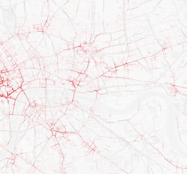
In my bachelor thesis I developed an algorithm that was able to map observations that were given by latitude and longitude data to the according street segment. This yields a much more insightful visualization that a normal heat-map or individual points.